blah blah blah
Clark Summit
Length: 2.1 miles out-and-backDifficulty (click for info): Easy
Elevation Gain: 430 feet (+190 feet on return)
Rating (click for info): 6/10
Elevation: 1569'
Prominence: 520'
Driving Directions:
Trailhead is on Wolf Hill Road in Deering, NH. Wolf Hill Road begins on the west side of Rt. 149 0.9 miles north of the town hall in the center of Deering and 3.2 miles south of the traffic light in the center of Hillsborough. Look for the signs marking the entrance to His Mansion Ministries; note that there is another entrance 0.5 miles to the north (across from Dickey Hill Road), but this way is longer. Drive 0.3 miles up the access road and bear left when the other access road comes in from the right. Continue 0.2 miles through the center of the complex up to the point where the road becomes class 6. Park on the shoulder here (not in any of His Mansion's parking areas). Click here for a Google map.
About the Hike:
Named to honor First Lieutenant Clark Vandersall Poling, a Word War II hero who gave his life distributing life jackets to fellow troops on a sinking ship, the low, rocky nubble of Clark Summit is the highest point in the town of Deering. It is quite unknown to hikers, offering wide views of the Monadnock Region with likely solitude. Hikers can reach its summit via an unofficial path on the property of "His Mansion Ministries", beginning at the top of nearby sub-peak Wolf Hill, which itself offers fine views similar to those seen from Clark Summit.
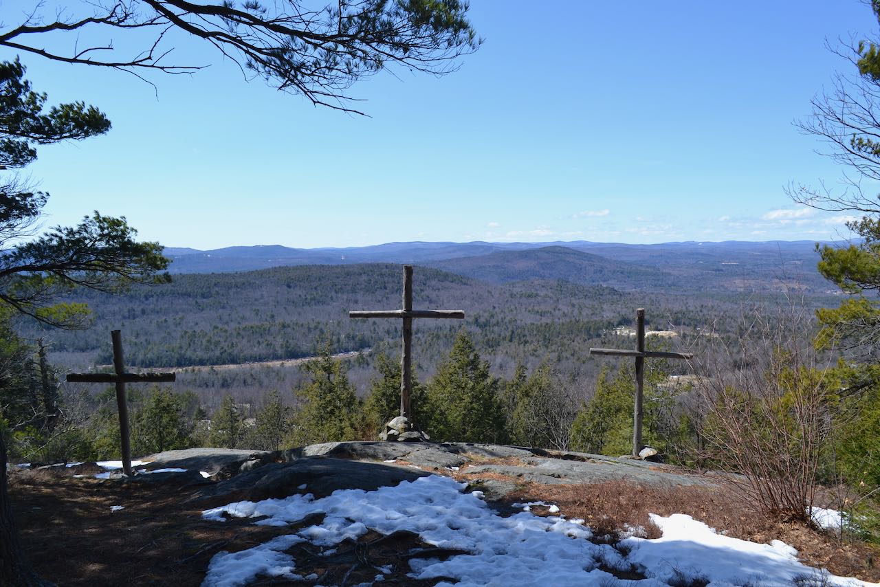
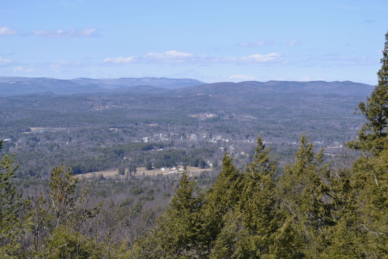
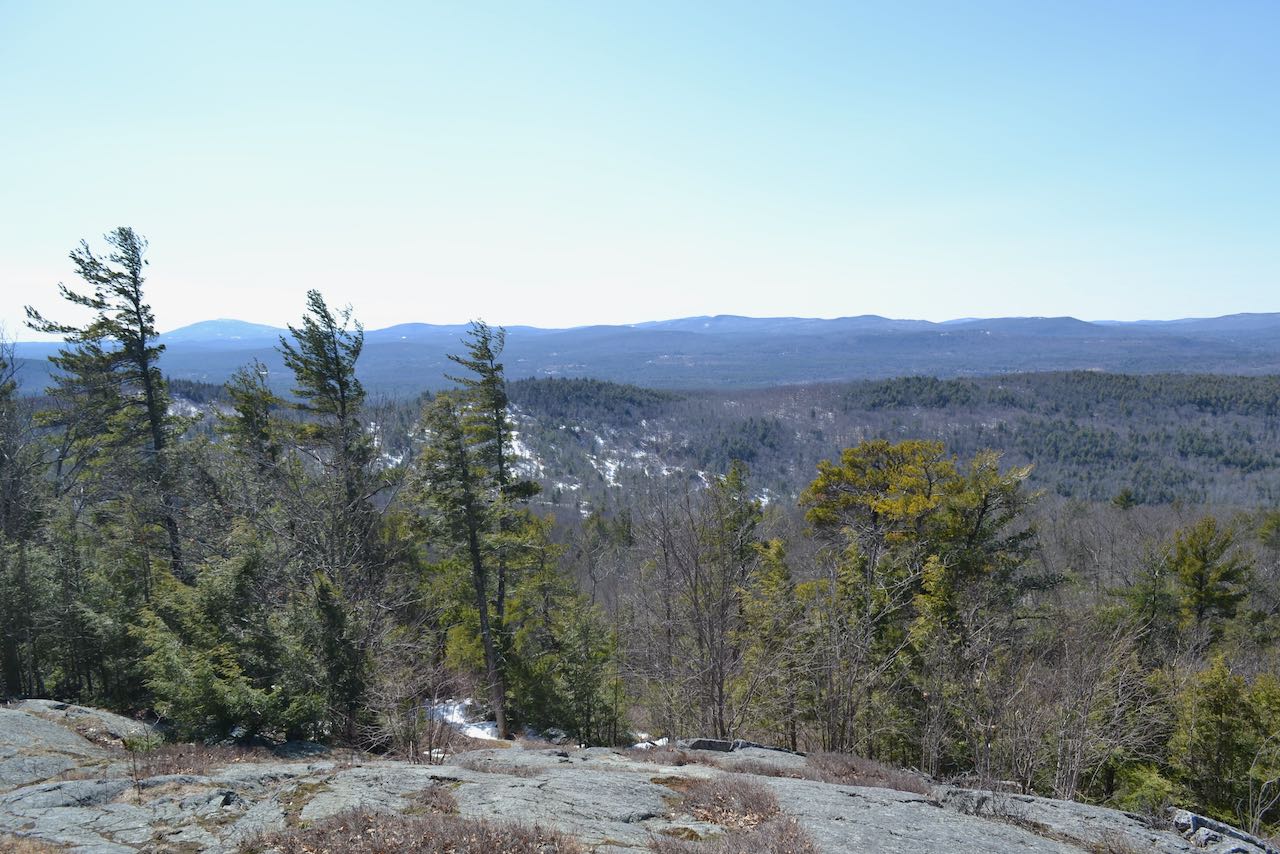
To reach Wolf Hill, you will need to walk up the access road to the cell tower which occupies the summit. From your parking space, walk back a few feet toward the center of the complex, and turn left up the first road heading uphill. Stay straight as the road leads up 0.1 miles past several buildings and a woodpile to cross a power line clearing, where there is a gate. From the gate, it is about 0.3 miles to Wolf Hill as the road climbs gently to an open field, then swings right up to the cell tower. Follow the path to the left of the cell tower past an opening in a stone wall with a sign (this is the trail you will take to Clark Summit) to the first viewpoint, where there are three crosses set up by His Mansion and an excellent view overlooking the countryside. Step out onto the ledge and look all the way to the left to observe Mt. Monadnock. In addition to Monadnock, you can also see the two summits of Skatutakee and Thumb Mountains next to the right, as well as the long, flat ridge of Bald Mountain further over. On the opposite side of your view, you look north to two similarly-shaped broad masses - Bradford's Rowes Hill to the far right and more distant Mt. Sunapee to its left. The prominent pyramid of Lovewell Mountain appears at the left end of the Sunapee Ridge.
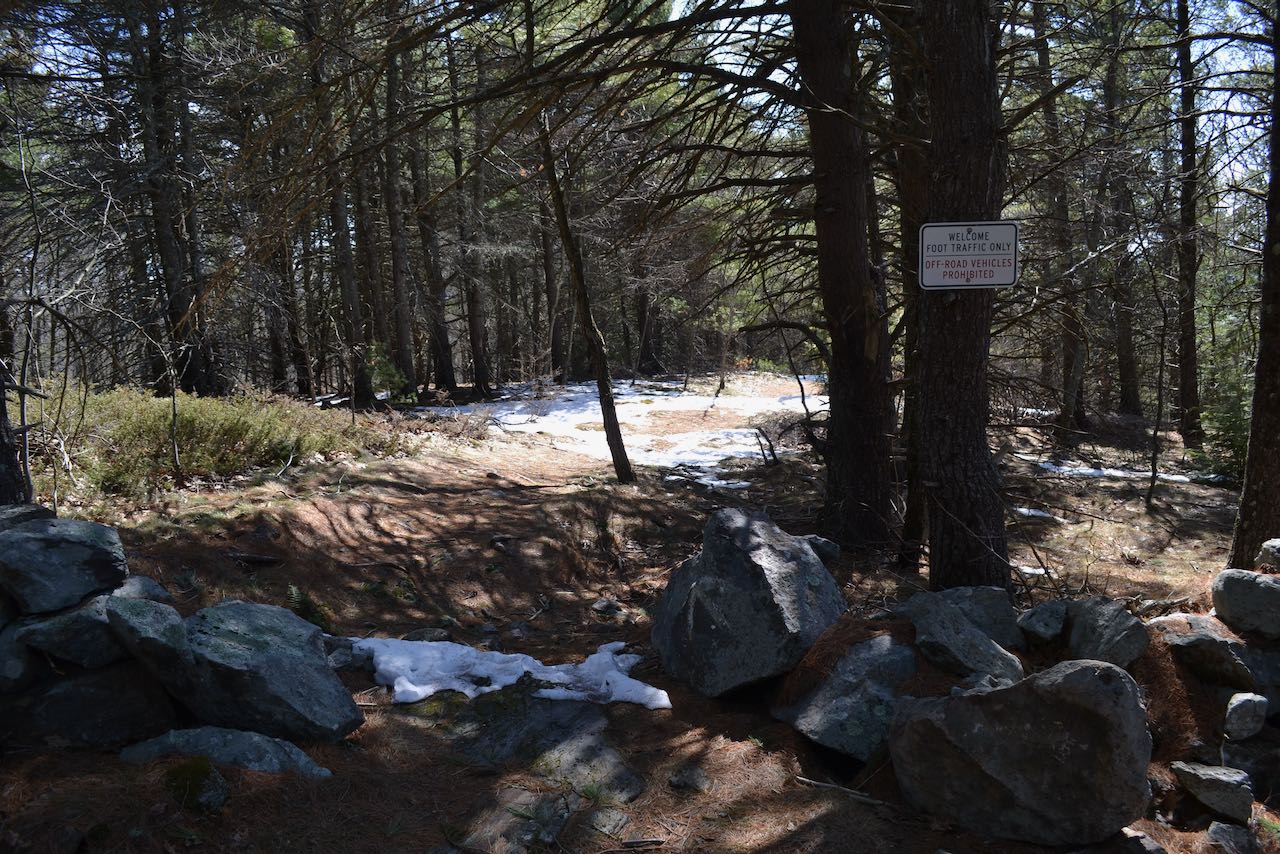
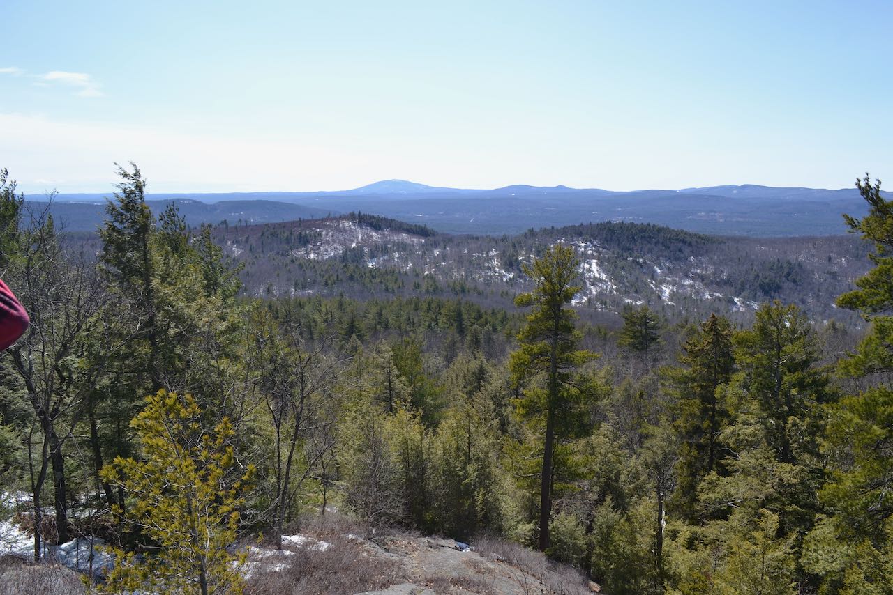
To continue to Clark Summit, go through the opening in the stone wall and follow the white-blazed trail across the ridge. The trail heads out into pleasant open forest and makes a short, winding descent to the low point between Wolf Hill and Clark Summit in 0.2 miles. Note this location for the return trip, as you will notice a diverging path on the east side when travelling the other direction, with a white arrow pointing toward it. Just remember to bear left when you cross this spot on your way back, as the way the arrow points is a less direct route back. The trail then continues up the narrow ridge at moderate grades, climbing over some minor ledges before emerging on the open summit in 0.3 miles. As you walk over to the high point, you will find a plaque with the story of the hill's namesake. The open ledges atop Clark Summit provide more expansive views overlooking the same terrain you saw from Wolf Hill. For a better view toward the area around Mt. Monadnock, climb down around the steeply pitched ledge on the west (right, looking from the trail) side, and follow a beaten path out to some lower ledges atop a small dropoff, where you look over the timbered slopes on nearby Hedgehog Hill.
Printable directions page